The Earth's surface is constantly in motion, a phenomenon often overlooked by many. Scientists have long relied on satellites and ground instruments to track movements associated with earthquakes, volcanoes, landslides, and other geological events. Now, a new satellite named NISAR, developed through a collaboration between NASA and the Indian Space Research Organization (ISRO), is set to deepen our understanding of these changes, offering improved preparedness and response to natural disasters.
NISAR, short for NASA-ISRO Synthetic Aperture Radar satellite, will observe the movements of nearly all land and ice-covered regions of the Earth every 12 days. This high-frequency data collection will enable researchers to gain a more comprehensive understanding of how the Earth's surface evolves over time.
By combining measurements from NISAR with data from other satellites and ground instruments, detailed information about horizontal and vertical movements of the Earth's surface will be provided. This data is crucial for studying everything from crustal dynamics to identifying regions prone to earthquakes or volcanic eruptions. NISAR can also be utilized to detect damage to dam structures or signs of landslides on slopes.
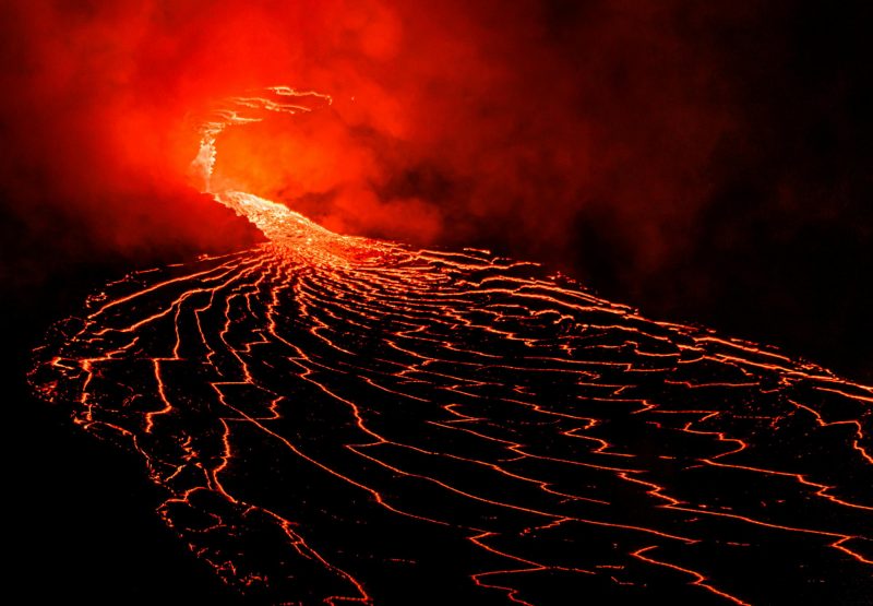
For volcanologists, long-term monitoring of surface movements is particularly vital as it can signal potential volcanic eruptions. When magma moves beneath the surface, the ground may experience uplift or subsidence. Data from the NISAR satellite will aid scientists in a more comprehensive analysis of changes in volcanic terrain, allowing for assessments of whether these changes indicate an impending eruption.
Enhancing Earth Surface Monitoring with NASA-ISRO Satellite Collaboration

Tags
A groundbreaking study by scientists from Pennsylvania State University and Columbia University, recently published in Nature Geoscience, reveals that Earth's continents owe their long-term stability—and their role as the cradle…

A new NASA study indicates that Saturn's largest moon, Titan, may host naturally forming primitive cell-like structures called vesicles within its liquid hydrocarbon lakes. The finding offers fresh insight into…

Earth's climate has swung dramatically between extremes of ice and heat throughout its history. In fact, for much of geological time, Earth has been a warm, ice-free planet. During the Cretaceous…

Core Leak? Study Suggests Earth's Core Material May Be Reaching the Surface via Volcanoes
A groundbreaking study from the University of Göttingen challenges long-held assumptions about Earth's internal structure, suggesting that material from the planet's core may be leaking to the surface through volcanic…
Managing Underground Pressure May Prevent Volcanic Unrest in Southern Italy, Study Finds
Frequent earthquakes in Italy's Campi Flegrei volcanic region since 2022 have raised safety concerns for hundreds of thousands of residents, particularly around Naples. A new study led by researchers at…

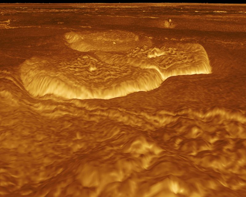
A recent NASA study reveals that large circular features on Venus—known as coronae—may be evidence of ongoing geological activity. The findings, published in Science Advances, are based on data collected…